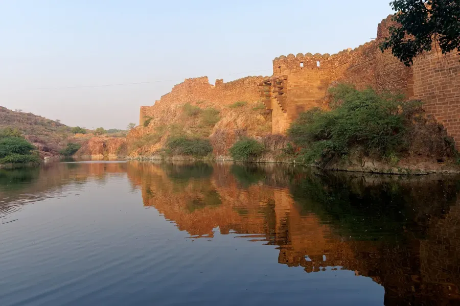
The first condition was geological.
Rao Jodha’s move from Mandore was shaped by an isolated rock south of the older capital. Elevation and natural defence made the ridge strategically useful; the fort then altered that land through walls, gates, outworks, palaces, paths, and water systems accumulated across centuries.
The ridge should not be romanticised as passive scenery. It constrained access, concentrated defence, shaped construction, and later became part of an urban and ecological landscape around the fort.
Mehrangarh Museum Trust history → (opens in a new tab)In an arid city, water is architecture and capacity.
Rajasthan Tourism and Mehrangarh’s interpretive material identify reservoirs, lakes, stepwells, catchments, and channels as part of Jodhpur’s material water heritage. Ranisar and Padamsar are adjacent artificial lakes close to the fort; Balsamand and Kailana belong to a wider landscape of stored water; Toorji Ka Jhalra makes descent and access visible in stone.
Mehrangarh’s trail calls Ranisar Rani Sagar, “the queen’s lake.” It says the lake was named for a queen of Rao Jodha, describes Rao Jodha only as its probable builder, and records a western outwork added by Maldeo. Rajasthan Tourism more specifically attributes Ranisar to Queen Jasmade Hadi and currently dates both adjacent lakes to 1459, while its Padamsar wording creates a chronology question that still needs archival reconciliation.
A historical outwork is not evidence of today’s fencing or public-access condition. This page therefore does not state the present barriers, water extent, inflow, water quality, safety, conservation outcome or municipal role without a dated field and authority review. Material survival and present interpretation are not the same as contemporary utility performance.
A water structure can be historically attested, physically extant, and culturally interpreted without evidence that it remains part of today’s municipal supply network.
A social memory of ecological refusal.
Rajasthan Tourism describes Khejarli as a Bishnoi-community village and records that Amrita Devi and 362 other people—363 in total—were killed there in 1730 while resisting the cutting of khejri trees during Maharaja Abhay Singh’s reign. The event is a major part of Marwar’s environmental and community memory.
This page does not simplify that episode into an unsupported superlative such as “the world’s oldest environmental movement” or “the first Chipko movement,” nor does it claim a direct institutional line from Khejarli to every later conservation project. A deeper visitor page must be community-reviewed and must distinguish the official historical summary, living Bishnoi experience, memorial practice, present ecology and commercial tour products.
Rajasthan Tourism Jodhpur record → (opens in a new tab)The fort’s edge becomes a restoration landscape.
Mehrangarh Museum Trust created Rao Jodha Desert Rock Park in 2006 to restore the natural ecology of degraded rocky land beside the fort. The Trust states that the park extends across about 70 hectares, or roughly 170 acres.
Those facts establish purpose, date, and stated extent. They do not by themselves quantify ecological recovery, biodiversity outcomes, water performance, or long-term resilience. Those would require monitoring data beyond the institutional visitor page.
Rao Jodha Desert Rock Park → (opens in a new tab)The future plan names both growth and limits.
The Jodhpur Master Development Plan 2031 distinguishes urban layers and highway corridors while also naming water bodies, hilly conservation, forest and plantation areas, reserves, rural land, and other uses. It translates a regional population estimate into requirements for water supply, sewerage, and other public systems.
This recurrence—land constraining settlement and water defining capacity—is analytically useful. It does not prove that the historical and planned systems are spatially identical, that conservation succeeds because it is mapped, or that infrastructure requirements have been delivered.
The connection is a reading pathway through sourced records, not an unchanged tradition, a causal chain, a GIS overlay, or a claim that the approved plan resolves the problems it names.